


Carrick MTBO Final Info
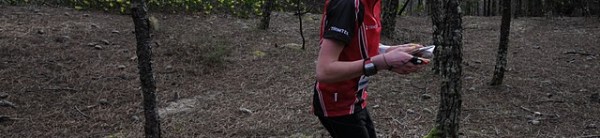
Courses are finalised for Saturday’s mountain bike orienteering event at Carrick Mountain, Glenealy. The courses will be about 16 km and 11 km by the optimum route (i.e. measured along the way you might actually go, not by straight lines). Courses will be faster than the Djouce event with less single-track and more forest roads.
Carrick has changed a lot since we last mapped it in 1990: most of the runnable forest on the map is now impenetrable and vice versa, but the road and track network is essentially unchanged.
Carrick has also become a hot spot for mountain biking: last weekend there was a “Gravity enduro” race there with five special, largely downhill, timed stages. The event used SportIdent timing for each stage and the total time determined the winner. See details here.
Start times for Saturday 15th are 11.30 to 1 pm. Registration from 11.00.
Directions: from Dublin take the N11/M11 south and leave at Junction 15 (Ashford). Go through Ashford and fork right at the end of the village, just before Mount Usher gardens. Follow this road towards Glenealy. Just before Glenealy, fork right at the GAA pitch onto a small road by a little church and go to the end of the road where parking is located. This is a narrow road with several houses so please drive carefully.
Maps will be premarked and SportIdent timing will be used. Expect some quite long legs (remember it’s a big area). Cycle helmets are compulsory. Tools and mobile phone are strongly recommended.
Please ride sensibly and look out for other forest users, walkers and other MTB-ers. On some of the tracks, depending on route choice, you will meet other competitors going the other way, so be careful. The forecast for Saturday is good.
John McC